• For more information on how to avoid pop-up ads and still support SkiTalk click HERE.

Does anyone know what ski area this is?

dbostedo

Asst. Gathermeister
Moderator
Contributor
SkiTalk Supporter
Joined
Feb 9, 2016
Posts
18,328
Location
75% Virginia, 25% Colorado
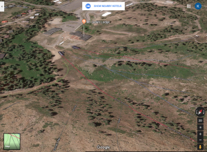
Looks more like a drone shot it is too close to be a NASA shot.

It's certainly not too "close" or detailed to be a satellite image. Commercial satellites can resolve things down to less than a meter. But I think it could very well be an aerial shot as I think Google maps uses a lot of those for their more detailed views of things.
 

Uncle-A

In the words of Paul Simon "You can call me Al"
Skier
Joined
Dec 22, 2015
Posts
10,957
Location
NJ
It's certainly not too "close" or detailed to be a satellite image. Commercial satellites can resolve things down to less than a meter. But I think it could very well be an aerial shot as I think Google maps uses a lot of those for their more detailed views of things.
Yes the detail is very good with a satellite image but the perspective is different it is obvious that the satellite images is taken from a greater distance even though it has the good resolution.
 

steve pickard

Putting on skis
Skier
Joined
Nov 17, 2015
Posts
57
Location
Grass Valley, CA
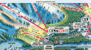
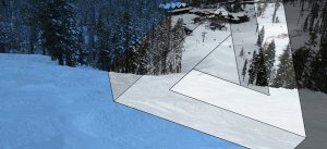
Yes, it's Sugar Bowl and looking from the top of Donner Way. Everything that's been said to verify from the sattelite view is correct. The other thing that really tips it off is the trail map board between the two lifts.
 

Dave Petersen

Graphic Designer/Social Media Manager
Admin
SkiTalk Supporter
Joined
Nov 16, 2015
Posts
9,893
Paradox Graphic - Pugski - Mendieta, Petersen.jpg

We used a similar shot for @Mendieta 's slider.
 

Sponsor

Staff online

  • Andy Mink
    Everyone loves spring skiing but not in January
  • Dwight
    Practitioner of skiing, solid and liquid
Top