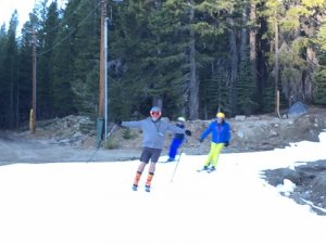
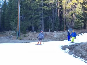
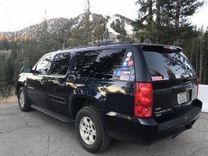
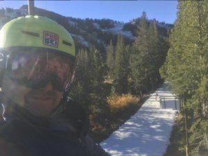
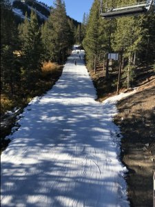
Supposed to cool down at the end of this week and quite possibly a medium sized storm at the end of next week . . .Mt Rose does open tomorrow, but in a very limited way.
Things at work got so busy that I simply won't be able to go. But I thought I would share! We are on!
-
For more information on how to avoid pop-up ads and still support SkiTalk click HERE.
You are using an out of date browser. It may not display this or other websites correctly.
You should upgrade or use an alternative browser.
You should upgrade or use an alternative browser.
California/Nevada 2017-18 Tahoe Ski Resorts/Conditions/Meetups Thread....
- Thread starter Jed Peters
- Start date
- Status
- Not open for further replies.


See you there!
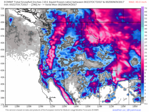
There is a currently forecast system for around 20" of snowfall for the Tahoe region on EC. This is from Friday to Sunday morning. Mammoth looks to pick up around 30" of snowfall. So they are serious storm totals, especially for this time of year.

GFS shows similar totals for the Tahoe region (sorry for the terrible resolution) and potentially 40-45" for Mammoth. It's still a fair way away and the ensembles aren't entirely onboard with the massive snowfall totals for this time of year, but I think this could produce some serious snow. I'll post an update on this in a few days
Last edited:
Looks like that's over a 10-day period? Am I reading it right?View attachment 32127
There is a currently forecast system for around 20" of snowfall for the Tahoe region on EC. Mammoth looks to pick up around 30" of snowfall. So they are serious storm totals, especially for this time of year.

GFS shows similar totals for the Tahoe region (sorry for the terrible resolution) and potentially 40-45" for Mammoth. It's still a fair way away and the ensembles aren't entirely onboard with the massive snowfall totals for this time of year, but I think this could produce some serious snow. I'll post an update on this in a few days
Looks like that's over a 10-day period? Am I reading it right?
Yeah, I think it would help us, mere mortals, if you (@Jellybeans1000 ) could add a little bit info, such as storm projected start/end range.
@The Dad (and others): there is a pretty good read about that storm by BA at OpensSnow
Yeah, I think it would help us, mere mortals, if you (@Jellybeans1000 ) could add a little bit info, such as storm projected start/end range.
@The Dad (and others): there is a pretty good read about that storm by BA at OpensSnow
I agree.
I love reading the forecasts & I appreciate that you wrote the potential amounts. How about adding the dates, expected snow levels, temperatures, wind speeds etc.
Thanks
Will suggest weather enthusiasts visit the below NWS forecast discussion link during our winter season if they wish to understand what is going on with forecasted storms. Generally more than a few days off into the future, specific data models generate are unreliable and instead ought be just vaguely interpreted.
http://www.wrh.noaa.gov/total_forecast/getprod.php?prod=RNOAFDREV&wfo=mtr&version=0
Area Forecast Discussion National Weather Service Reno NV
snippet:
.Pattern shift is looking likely for the end of next work week and
into the weekend with cooler, wetter, and windier conditions
possible...
The greatest forecast concern comes for late week into the weekend
as a longwave trough sets up over the west and several pieces of
energy move into this trough both from the north and also from the
Pacific. This will bring further cooling and increasing winds along
with chances for rain and snow. The details are somewhat nebulous at
this point with timing differences of a day or two a definite
possibility, depending on how multiple factors come together. The
biggest takeaway at this point is travel could be impacted,
especially across mountain passes toward the end of the work week
and into the weekend. -Dawn
Correct. 240 hours = 10 days.Looks like that's over a 10-day period? Am I reading it right?
Yeah, I think it would help us, mere mortals, if you (@Jellybeans1000 ) could add a little bit info, such as storm projected start/end range.
@The Dad (and others): there is a pretty good read about that storm by BA at OpensSnow
Fair enough. The system is forecast for Friday to Sunday morning next week. Added the detail in. As for the snow levels, temps, wind, etc, it is pretty far away so I tend to exclude that information, until we get in a closer range. I will take that into more consideration in the future, thanks for the suggestions. I will provide a more in detail outlook soon.I agree.
I love reading the forecasts & I appreciate that you wrote the potential amounts. How about adding the dates, expected snow levels, temperatures, wind speeds etc.
Thanks
Thanks for the NWS link @SSSdave.
How was it?

See you there!
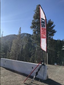
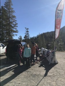
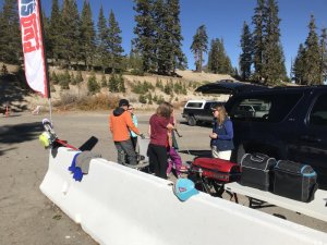
Best 10/27 skiing EVER. It was real good until it started getting crowded..around 10AM. Will go tomorrow,, in line by 7:45 and will be done with drink in hand by 10AM. Look for the Pugski banner in the upper parking lot after 10How was it?
Wish I could go-have to workBest 10/27 skiing EVER. It was real good until it started getting crowded..around 10AM. Will go tomorrow,, in line by 7:45 and will be done with drink in hand by 10AM. Look for the Pugski banner in the upper parking lot after 10
Without doubt, better than any snow I saw today.Best 10/27 skiing EVER. It was real good until it started getting crowded..around 10AM. Will go tomorrow,, in line by 7:45 and will be done with drink in hand by 10AM. Look for the Pugski banner in the upper parking lot after 10
This is the difference between leaving 45 minutes away from the slopes:
And living hours away:
So, yes, how I wish I could live much closer to skiing. Maybe in the future!
Now, how come our dear site owners didn't take ONE picture of the event? For all I know, for lack of hero snow, they called the big guns and provided superhero snow!

Best 10/27 skiing EVER. It was real good until it started getting crowded..around 10AM. Will go tomorrow,, in line by 7:45
And living hours away:
Wish I could go-have to work. Have fun!
Without doubt, better than any snow I saw today.
So, yes, how I wish I could live much closer to skiing. Maybe in the future!
Now, how come our dear site owners didn't take ONE picture of the event? For all I know, for lack of hero snow, they called the big guns and provided superhero snow!

They've really got the R part of WROD down pat out there! 
Renouns for WROD? Livin the life man!
Renouns for WROD? Livin the life man!
You know you have it good when your rock skis are Renouns Stocklis ors Kastles !
- Status
- Not open for further replies.
Sponsor
Staff online
-
T-SquareTerry
-
Jim KenneyTravel Correspondent


